Thursday 24 July 2014

21) Western Australia: Derby to Yampi Sound. 24 July to 6 August, 2014.


After managing to get all the food and fuel on the boat and the car returned we stayed not a moment longer as we had hit the jackpot to get out of Derby, safely. There was wind from the right direction (for a change), it was still neap tides (lower high tides and higher low tides), it was high tide (to get over the bar) and lastly the ebb tide (out-going) was about to start and would help propel us north, up King Sound. The only problem was that it was just a few hours before dark, so we sailed until dusk and then pulled up on the nearest mud flat, 15m deep and waited out the night. We did this two nights running and they were not very pleasant. Not only was the incoming or outgoing tidal streams screaming past us but the wind came up overnight and made it very rocky, as there was no protection for our boat from the land. Not much sleep was had during either of the two nights – attending to anchor alarms and being tossed around the bed, doesn’t make for much sleep. 

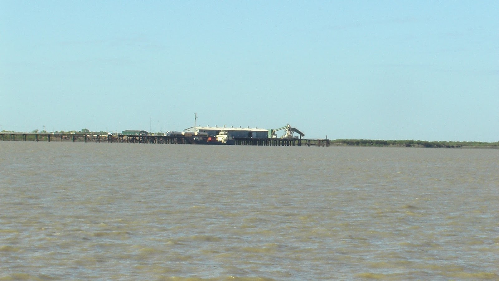
The next week saw us slowly make our way north. As you know we have to sail to conserve fuel plus we didn’t see beautiful King Sound on the rush south to Derby. Not many cruisers make it to King Sound, so it is a bit of a well-kept secret that the upper half is stunning. The lower half approaching Derby is made up of low lying lands, mud flats and brown water. In contrast the upper coast is hilly, has numerous islands, lovely beaches and crystal clear water. The islands and jagged mainland make for plenty of sheltered anchorages where you can get out of the tidal stream and rest up before again tackling the hair-raising water rush north.


Eddies and whirlpools everywhere.

The sheer volume of water that moves in and out of King Sound each tidal period is amazing, and it creates a lot of overfalls, eddies and whirlpools in the process. Sailing through some passes is not an option as the current just takes you on a ride. To add to the complexity there are numerous reefs, rocky crags and islands, so negotiating them under motor and near slack tide is a much more comfortable experience.  


Northern King Sound.


Unnamed bay.
Slowly we made our way north stopping and sheltering in as many anchorages as we could get into and out of safely. Of note there was Crystal Bay, the northern and southern bays of the Gerald Peninsula, Strickland Bay, the eastern side of Whirlpool Pass and a small un-named bay on the western side of Hidden Island. All these anchorages were deep, protected from the current and pretty.


At the northern extremity of King Sound we motored on the ebb tide north around the western tip of Hidden Island and into pretty Yampi Sound.

Silica Beach, Yampi Sound.

There are numerous yellow sand beaches on Hidden Island but right smack in the middle of them sits a large pure silica beach. It is so white you can see it for miles. Anchorage around this area is too deep and it would be a worrisome night’s sleep, so after a good look around Silica Beach, we headed next door to Coppermine Creek. 


Yampi Sound is blessed with five river systems and all of them offer boaties safe and pretty anchorages - heaven. By the time we arrived in Coppermine Creek it was pitch black so we navigated with the chart plotter and headed for the deepest entry point. This was one of the few bays that was charted so we prayed that it was correct. Just inside the river is an anchorage and we quickly anchored in the lee of the eastern headland, in 12m. We didn't want to risk going in any further in the dark.


Cruising with dolphins, Coppermine Creek.
The next morning we didn’t bother moving, even though we could have gone in further the previous night. It was deep and quiet, so why bother. Coppermine Creek is on the list of our favourite anchorages and is a large body of water the goes inland for at least 4nm. There are numerous eastern bays, some excellent cyclone anchorages and even a bay that opens to the ocean further east.


Fishing camp, Oyster Bay in Coppermine Creek.


On the west is an abandoned fishing camp with a beautiful beach and plenty of yummy black lipped oysters. Hence that night Oysters Kilpatrick was on the menu for me and Oysters Naturale for Peter.


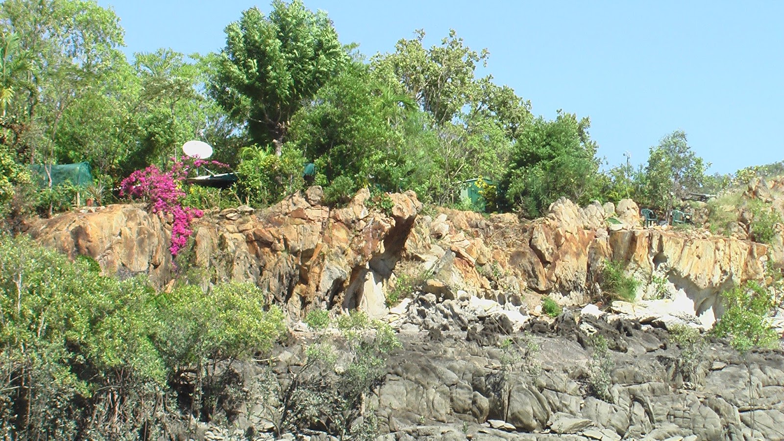
After a few days at Coppermine Creek we headed east to Myridi Bay. This bay is a relatively short, narrow watercourse and is protected by a large cliff face either side. Again after exploration it was time to move next door to Crocodile Creek. The sailing guide suggests anchorage here at either the mouth of the short river or right up at the waterfall. Neither option is that appealing frankly. The first is an open bay that is not that wide and also very exposed to wind, waves and swell. The latter is even worse. The channel to the waterfall is very narrow, torturous, shallow and has numerous obstacles. If you manage to get there after all this, you have to anchor in a tiny and not that deep pool. 


The climb up to the first pool.

There is no swinging room so a stern rope is tied to the waterfall ladder. We settled for the first option and took the dinghy to the waterfall and tied it to the ladder. This area requires a couple of hour’s exploration as there is much to see and do. You climb up the ladder next to the lower waterfall to a very deep pool with a cemented area next to it.


All that is left.

This area was a camp but had been destroyed some years previous by a cyclone. There are remains of a bed and kitchen sink. It is not wise to swim in the adjacent beautiful deep pool as crocodiles can make their way there easily courtesy of high tide. 


The deep upper pool emptying into the lower pool.

Climb the rocks past the second waterfall and you will be rewarded with a very deep series of rock pools. The water felt like ice after the hot climb, but was very refreshing. After this adventure we decided a better night’s sleep would be had next door at Silvergull Creek. 


Squatter's Arms.
When we had passed by a few weeks ago our friends, Mal and Shelley at Squatter's Arms, had invited us to return to attend the wake for Marion (the original squatter). We were hopeful to arrive back in time for this event but because we were so long coming back from Derby we thought the event had been and gone. Nope we arrived two days before the event and as there was no wind to take us north east across Collier Bay, we stayed over a couple of days for the wake. 


The day was beautiful and nine boats (25 people) arrived from all over King and Yampi Sound for the wake. There was even Skype hook up with the simultaneous event (over a 100 people) at the Fremantle Yacht Club. Yep, she sure was a favourite person and from what we had heard a bit of a character and larrikin.

After a few days it was time to bid farewell to newly made friends and head east while the wind was blowing. The forecast for the next few days was going to be for strong winds and worsening by the afternoon. So to avoid the worst of the winds we left the next morning at 4.30 am and first light. We had made it half way across Collier Bay to Melomys Island by late morning. Not bad going. Then the next morning we had strong winds all day and tacked back and forth, finally reaching Raft's Point by early afternoon. Yes we had been here before and it had become a reliable sheltered anchorage. This time we would finish seeing the remaining art galleries and check out Montgomery's reef. Hopefully, this time there would be calm weather which would allow us to get out there and anchor for a few hours.


Friday 18 July 2014

20) Western Australia: The Buccaneer Archipelago to Derby. 18 to 23rd July, 2014.

 
Well we managed to motor out of Dugong Bay with less stress than we had on the way in. The weather was benign and it was near slack water so we slowly motored north from our anchorage across the bay and into the tight right hand turn followed by a quick left hand turn and the narrow passage, or the 'S bend' as we unaffectionately called it. 


We had carefully placed our waypoints on the chart plotter and religiously retraced the same path we had come in on. Once through the islands and reefs we were hoping to put up the sails but the wind never eventuated. This necessitated a lot of motoring and we knew we would have to buy some fuel from the fuel barge near Koolan Island otherwise we would not get to Derby. There are only four places to get fuel in the Kimberley - Wyndham, McGowan's Beach, Dog Leg Creek and Derby.


On anchor around the corner from 'The Gutter'.


We decided to take the shortcut between Koolan Island and the mainland, through the narrow, but deep gorge, affectionately known as “The Gutter”, rather than go the long way, around Koolan Island to get into Yampi Sound.


This wasn’t a decision we took lightly, as we had a choice this time to avoid the treacherous water and narrow passage. But the weather forecast predicted very light to no wind for the next few days, meaning we would have to motor around Koolan Island. So we had no choice really but to go the shortest route, 'The Gutter', as our fuel supplies were dwindling fast. 

We prepared as much as possible – following the tide tables religiously, working out the exact route and time it would take to go through the passage. We had a lot of things in our favour – the weather was benign, it was just before noon (great visibility), and it was high tide and we could transit the entire passage on slack water. This meant the currents/flow within 'The Gutter' would be greatly minimised. After a rocky night’s sleep we set out, confident that we would get through without too much drama.

From the outset though we realised that the slack water had already come and gone. Yep, this area did not match the tide tables. Nevertheless we decided to continue as the flood tide pushing against us wasn’t too strong and we would be through the dangerous section within 30 minutes. 

We got to the deepest (40 m), narrowest (80 m) section and therefore the quickest flowing section, when the motor suddenly just died. Peter raced up on deck to get the anchor down and holding as quick as possible while I quickly kept the rudder in one direction, as the current would have us against the rocks in no time. In his haste Peter accidently let out all the chain (over 80 m). Luckily, he realised just in time when he saw the rope section and stopped it before the last bit slipped over the side and was gone forever. He then spent the next two hours removing a bacterial growth in the fuel filter, while I tried to keep the rudder in position while we wildly swung back and forth between two very large rocky precipices.

We could not think of a worse place for this to happen along the entire Kimberley coast. Why not happen in a quiet anchorage before we lifted the anchor – no of course not. Once the motor was working we had to wait another three hours until slack water again so we could lift the anchor up. We managed to get the chain back on the winch gypsy and once slack water came we were able to motor forward slowly pulling up the anchor a section at a time. A near death experience but luckily a major catastrophe was averted – thank goodness.


Koolan Island - Iron Ore Mine.

We then motored up without further incident past Koolan Island. This island was at one time pristine, but now it is an open iron ore mine. It is really weird to come all this way with no signs of life for months on end and then you round a corner and there is a big freighter being filled with ore, several anchored tug boats and even a fuel barge in the creek opposite. 


Paradise lost.


The option of getting fuel was too good to pass up. We did have enough provided we also got some useable wind but if we could not sail at all and were forced to motor all the way then we would not make it.


The fuel barge - Dog Leg Creek.


So we proceeded up Dog Leg Creek (yes it is shaped like a dog’s leg) to get some fuel. The Diesel was not cheap at $3.00 a litre but cheaper than the unleaded petrol at $3.50 a litre - they certainly were not giving it away. After we filled 8 containers we motored next door to Silvergull Creek for the night. 


Squatter's Arms.

The next morning we realised we had finally reached civilisation, well to some degree at least. There is a shack in a western tributary of Silvergull Creek which was initially set up by BHP. BHP had installed water tanks when a spring was found and it became the local watering point for the nearby mine of Koolan Island. 


'Exhuma' mast - stuck in mud at low tide.

When BHP pulled out many years ago, Phil and Marion from the boat “Exhuma” started a squat in the shipping containers, and called the place “Squatter’s Arms”. They were there for many years and provided a life line for many passing yachts. Sailors were able to get fuel from the barge in the next creek and then fill up their water tanks (and have a swim) at Squatter’s Arms. 


Peter, Shelley and Mal.

Over the years it has become a very popular destination and even cruise ships now drop in here as part of their Kimberley Cruise. Phil and Marion moved back to Derby in 2013 as Marion was very sick, and Mal and Shelley took over the management at Squatter’s Arms. In the dry season they often have boats drop in daily. In the wet season they have the barge staff over every three weeks or so. 


Shelley also advised us that there was no public transport in Derby and taxis were expensive, so she kindly offered us the use of her old car at Derby for a very reasonable daily sum. This was a win-win as walking 4 km to the shops and back, three times for food and about 10 times to fill up the fuel, well you get the picture - it wasn't really doable. 


King Sound is at the end of a complete tour of the Kimberley. Boats that tour the Kimberley often end their journey in Yampi Sound, see the sights, fill up the tanks with fuel/water and then return to Darwin or Wyndham. Others sailing south bypass the middle and lower reaches of King Sound and head directly to Broome. We were not heading to Broome and our food supplies were nearly exhausted as we only provisioned for a two to three month tour. So we had no choice really but to go to Derby to get another three month supply for the return trip to Darwin. 


Northern King Sound.


On the plus side we had been told that the northern end of King Sound was very pretty and worth the effort to see it. Beautiful water, beaches, quite hilly, pretty rock formations and some great anchorages. 


Southern King Sound.


On the down side though King Sound is fraught with danger towards the lower reaches and in particular anchoring in Derby. Low hills, dark brown water, mudflats and no anchorages.


The barge staff who traverse the Sound on a weekly basis gave us an idea of what to expect when travelling in King Sound. They warned that the Sound is tricky as it is a huge, wide and a funnel-shaped bay and the Indian Ocean rushes in on a flood tide and out on an ebb tide, both at a rate that is staggering. The tide can assist your passage south very nicely for six hours and then it will send you right back out again on the ebb tide. So you have to travel south for six hours and then anchor somewhere safe for the next six hours awaiting the next tidal cycle as your motor cannot push against the flow. The passage through the Sound and onto Derby can take a few days. Finding an anchorage in the upper and middle reaches is not really an issue and they provided some great options. Though they warned the problem was the lower reaches as there are no nice bays to anchor in, just exposed mudflats that are best avoided due to the shallow water. They suggested we stay near the main channel and anchor in a shoal patch of about 20m to await the next tidal cycle.

They also advised that the anchor may not hold if transit is attempted during a Spring tide (higher high tides and lower low tides). The water volume and rate of flow increase, so much so it screams past, and anchoring in Derby becomes too dangerous. This information later proved invaluable and we felt so fortunate to have met them at Squatter’s Arms.

Luckily for us it was the start of the neap tides and that would give us just over a week to get down the Sound, anchor in Derby and return before the next Spring tide. So no seeing Yampi Sound now, we had to leave ASAP to meet this new deadline. 

We left the next morning early and basically had to motor as soon as we approached King Sound. The wind had died and now there was none at all, so we just motored south as far as possible for six hours, anchored in a bay and waited another six hours, then did it all again.

Anchored at Derby with only 5 other boats.

We got to the southern end of King Sound and as advised there were no places to anchor out of the wind or current. So we just pulled over to the nearest shoal patch in 25m, and waited until the next tidal cycle, while hoping the anchor held in the strong current.


After two days we made it to Derby. We crossed the mud bar on high tide and then anchored in the only mud filled deep hole that Derby has. 


Anchoring and staying in Derby is not for the faint-hearted and it is daunting when you have no experience of it. Most of the anchorage is too shallow or it becomes a mud flat at low tide. The few deep holes that are available have a rock granule base (affectionately known here as coffee rock) which will not hold an anchor. There is only one anchor hole with good holding mud and that is where everyone is anchored. If you drag you are on a mud flat before you know it. So we waited on-board the boat for twelve hours to see if the anchor would hold in all tides – and it did.


Transferring all supplies from car to dinghy to boat.

So we quickly left the boat, went ashore, picked up Shelley’s car from Phil and got the food, fuel, gas and got rid of the huge pile of recycling.


Sunday 13 July 2014

19) Western Australia: Collier Bay to Dugong Bay. 13 to 18 July, 2014.

Well we were finally finding out about surviving the trials and tribulations of Collier Bay. Other yachties we had come across during our Kimberley travels had warned us about the huge tides and the unchartered or inadequately surveyed waters of this region and the need to respect mother nature and abide by the rules or we may come off second best.


Anchored at Raft Point, with Steep Island to port.

This part of the Kimberley has some of the biggest tides in the world and Collier Bay covers a huge expanse of water. So the sheer amount of water that rushes in and out with each tide is astounding and it creates a lot of disturbed water. Hence there are numerous eddies, overfalls and whirlpools that exists in this region.


We had a very quick and enjoyable trip down to Raft Point with the assistance of the flood (incoming) tide but as we got close to Steep Island and Raft Point we could see a lot of confused water up ahead. We quickly put down all the sails and turned on the motor as we were immediately aware that anchoring at Raft Point would be a challenge. Luckily we were heading into a strong breeze which did help us slow to some degree and we were nearing the end of the flood tide which wasn't propelling us south as quickly as it had previously been. Though it was still interesting getting through the whirlpools and eddies that exists between Steep Island and the mainland. Even with the motor going we would momentarily lose steerage and be taken for a ride wherever the water wanted to go.

Our visit to Raft Point also coincided with spring tides (higher high tides and lower low tides)

requiring us to anchor in 16m at high tide. When low tide finally did arrive we had dropped a whopping 12.2m in 6 hours and had only 1.5m of water under our keel. This was a record for us - the biggest tidal range we had ever experienced. 


The spirit "Wandjina".

That afternoon we checked out one of the three caves with indigenous art. The rest we would save for when we returned.


The weather prediction for the next few days was for very strong winds and not ideal for visiting Montgomery's Reef, one we would have to save for the return leg.


So the next morning we took the flood tide across Doubful Bay to Red Cone Creek. Accommodation was tight as every other boat in the region was seeking the same shelter, but we managed to squeeze in and had a very uncomfortable night.
 

Crossing Doubtful Bay to Red Cone Creek.


The following morning we left the creek on the next ebb (outgoing) tide to get back to Raft Point. The winds had decreased a little but not enough to be comfortably anchored at Montgomery's Reef, so we decided that we would head for Melomys Island, en-route to Talbot Bay to see the famous Horizontal Falls.


This would require us to cross Collier Bay from east to west but the tides actually only help propel you either north or south. So we needed reasonably strong winds, from the east through the south, to overcome the pull of the tides. 


Collier Bay - looking south to the mainland.
Luckily this is what the weather delivered. We left on the next ebb tide at 1.30 am, as the winds were very favourable at 20 to 25 knots and from the southeast. This was a very quick trip as we were able to do up to 9 knots, nearing Melomys Island just around daybreak. Given the favourable winds and the rest of the day to get to Talbot Bay we decided to keep going.


Confused waters of Talbot Bay.
We realised the downfall of this decision when we entered Talbot Bay. We always time our narrow passages and treacherous waters for slack tide. We would have timed our entry better had we stopped at Melomys Island. But we didn't this time and were now faced with entering both a tight passage and the treacherous water of Talbot Bay on a flood (incoming) tide. There was no anchorage we could take to await slack tide so we were committed. 


I don't think either of us had been this worried and stressed out about doing a crossing before throughout the whole Kimberley trip. We gently motored into the passage and before we knew it, we were being flushed south, like through an 'S' bend'.


Catamarans, seaplanes and jet boats.
Peter kept the motor idling to give us steerage, though the water took us for a ride through each eddy and whirlpool. I kept calling out depths so Peter could make small adjustments to avoid coming too close to shallow water and being propelled onto the nearby islands. Luckily the wind was now very strong and coming directly from the south which helped slow us down a little bit but we still managed 7 knots.


Once down in Talbot Bay slack water finally arrived and we anchored near the permanently moored catamarans but out of the seaplane landing zone, and enjoyed evening celebrations for Peter's birthday. Most people coming to see the falls fly in by seaplanes from Broome for half or full day packages. But luckily they were not fully booked and we managed to squeeze onto one of the jet boats for the next day.


Near blind Tawny Nurse Sharks.

First up was the feeding of the Tawny Nurse sharks and then a tour of nearby bays. Finally the thrill we had been waiting for, a jet boat ride through the Horizontal Falls. We were told that we had arrived at a good time as the spring tides were still with us. Lower lows and higher high tides mean an increase in the drop between the falls.


The 1st pinch point in the escarpment.

The Horizontal Falls are made up of two very tight and deep pinch points in the sandstone escarpment. On a flood tide (incoming) the Indian Ocean rushes into Collier Bay, then into Talbot Bay. Lastly it rushes through the two pinch points on the western side of Talbot Bay. 


The 2nd pinch point.
 
As you can imagine a lot of water has to squeeze into these two smaller bays through the very narrow openings each tidal cycle. So there is a time lag when the tide is higher in Talbot Bay and lower in the two smaller bays. Sometimes the difference between Talbot Bay and these smaller bays is up to 5m. Luckily for me on the day the difference was only 3m.


A huge whirlpool.


The second opening is only 20 m wide but because of the erosive power of the water it is 40m deep. As the jet boat races through, it feels like you are riding down a steep water escalator. 


The narrow pass is in the background.


The next day we left Talbot Bay towards the end of the ebb tide to get a free ride out and into the adjacent Dugong Bay. This bay is again huge but the entry is even scarier and there is only word of mouth to help with the navigation. 


There are four exceedingly narrow and treacherous entries to bays in the western Kimberley. Two are short cuts and therefore the less scary option is the route best taken. The other two are the only options, and if you want to visit you have go through them. One, Talbot Bay, we had just accomplished whilst adding a few grey hairs to our heads. The second, Dugong Bay, we were about to undertake but this time there was less room for error. 


Very placid Dugong Bay.
The reason, the passage is even narrower and at the last section the sandstone escarpment narrows into an 'S' bend. Necessitating a sharp 90 degree right hand turn and then a quick 90 degree left hand turn. The bend is only about 20m at its widest point but up 42m at its deepest, shallowing significantly as you get closer to the rocks. You really do need to stay exactly mid channel, after avoiding the mid channel rock that is.


Spectacular Falls - now a trickle.


Given the complexity of this treacherous path it can only be undertaken at slack water. Luckily there is an nearby anchorage one can take to await the slack water as any degree of flood tide would force you onto the rocks. This time we had timed our entry perfectly but it was still a scary adventure given the topography. At least this time we were able to go through very slowly at our own speed instead of being flushed down, through the 'S' bend.


Our only neighbour.

Once through the passage the bay opens out and you realise just how beautiful it is. The water slows and the bay becomes like Lake Placid. The sandstone escarpment to the SE is at least 200m tall and the SW about 100m. There are also three waterfalls in the bay to explore. Given the time of the year two were dry and the 3rd was merely a trickle. 


Dugong Bay at sunset.