 |
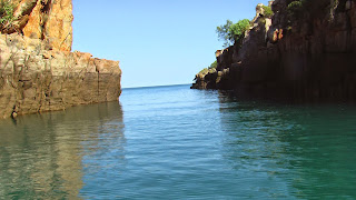
| The narrow passage between Gray and Glauert Island. |
The following morning we set off just before slack tide for the short ride across Port Nelson to our next anchorage, Ivy Cove. This well protected anchorage is inside the narrow and fast flowing passage that separates Glauert and Gray Islands, of the Coronation Island group.
 |
| The "Ivy" tree. |
This passage is best negotiated in slack water at the end of low tide and entering mid channel to avoid the hazards at either end of the northern or southern entrances. Once inside the passage you can anchor in the little cove on the west side of Glauert Island, just out of the tidal stream and wind from every direction.
 |
| "Ivy - 19/10/1891". |
There is a large boab tree sitting in the centre of the beach just on the tree line, and it is well worth exploring. The engraved boab tree features the date 19/10/1891 and was carved by the crew of the "Ivy", a local pearling schooner that operated in these waters at that time.
A recommended great spot, Careening Bay, was just south of the Coronation Islands and definitely a place we wanted to see, but we decided that we would see it on our way back. It was already July and we had a few issues playing on our mind. Firstly, we still had a long journey in front of us to get to Derby and then back to Darwin. Secondly, and probably more importantly was the fact that the dry season was in full swing and the waterfalls that we were still to see, were drying up fast.
 |
| Bat Island Beach. |
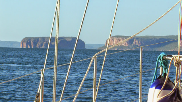
So over the next few days we quickly ticked off Bat Island Bay, in the lee of Cape Brewster, and then rounded Red Bluff and sailed into Port George IV.
Port George IV is really a large bay that is well protected by Augustus Island, and hence has some very well protected anchorages. One of the best being Tenggara Bay. This bay can seem difficult to navigate at first as the entrance is almost completely fenced off with buoys, to alert the presence of pearl farms, but if you follow the buoys south and then turn into the bay just near the southern beach, the access is relatively easy. The southern beach offers good protection from the trade winds and is great place to explore four beaches in the vicinity.
The only problem with Port George IV is transiting the notorious Rogers Strait in the south that separates Augustus Island from the mainland. This area is unchartered and there are only stories and 'mud maps' to help you navigate the strait. If you can obtain some co-ordinates from someone who has recently made the crossing then this is a distinct advantage. To add to the complexity there are many reefs, mud banks and some pearl farming activities are still in operation within the area, that make the safe channel through the strait a very narrow one.
The timing of your transit through the strait is probably the most crucial issue. Firstly, it is best to negotiate the passage (from both the north and the south) on a calm day, at slack water and a neap tide where the flow within the passage is at its weakest. Anchor at Kuri Bay or the neighbouring bay to await timing if heading north, or await in Tenggara Bay if proceeding south. Secondly, to allow passage south from Tenggara Bay you need the incoming (flood) tide. We waited in Tenggara Bay and left halfway through the tidal cycle (heading towards high tide) and arrived at the entrance to the strait at 1.30 pm, an hour later. We then motored through the strait just before high tide (2.40 pm), and had anchored by 3.30 pm. This was a great run - assistance of the flood tide down, gentle flow and deep water through the passage, and anchored before the outgoing (ebb) tide really got started.
 |
| Needle Rock. |
Anchoring for the night in the un-named bay next to Kuri Bay, as we realised that the last obstacle “The Needle” needed a reasonably high tide and either a flood tide or slack water, anything really, other than the ebb tide that was now pushing against us.
Once past this obstacle the next morning we sailed south to Sampson's Inlet. Billed as the cyclone anchorage for the Kimberley we knew it would be good. After anchoring we spent the afternoon checking out the inlet. There were two waterfalls to check out plus three barges.
 |
| Accommodation and Gym. |
On investigation the barges (one complete with gym equipment) obviously part of a pearl lease, were all abandoned and the waterfalls were well on their way to a trickle, but they were still beautiful.
After two lovely days in Sampson's Inlet, you guessed it, time to move on. We had a good sailing day so we made the short hop south to Deception Bay in good time. Deception Bay provides many good anchorages for winds from all aspects, except probably a westerly. It is also a playground for whales and we saw many inside the bay and outside in the larger Collier Bay. It appears they are also pretty used to many sailboats and cruise boats getting close and then hanging around to check them out, which is what we did while they flipped and flopped. We decided to stay two days in Deception Bay as it was pretty and comfortable.
Since David and Lyndell had left us we had not seen another boat at all. Finally, we did see signs of life when a few of the larger cruise boats that operate out of Broome and see all the sights as far north as Collier Bay, made it to Deception Bay. Though they were way too busy getting through their hectic schedule to contact us by radio. However, we did manage a visit from a Western Australian Fisheries patrol boat. This indeed was a highlight for us as we got to have our first conversation with another human being, in weeks. Plus we didn't have any fish on board except some frozen smoked salmon, so we didn't have to worry about the possibility of a fine either.
 |
| Langgi stone figures. |
The following morning we headed south to Langgi to see the stone sculptures, at the beginning of the flood tide. One thing you have to contend with when you come to the western Kimberley is the huge tides, some of the biggest in the world, and none more so than in Collier Bay and King Sound.
You have to be mindful that when you are travelling in these two large bays that you have to go south on a flood tide (incoming) and hopefully complete that journey, reaching your destination within six hours. Otherwise the tide will turn and you cannot push against it unless you have a big boat with a very strong motor and using heaps of fuel. If you do not reach your destination in the allocated timeframe then you have to anchor to await the next flood tide. This sounds simple but in reality it can be difficult in Collier Bay as there are not that many anchorages to be found. The area is inadequately charted and parts are uncharted, there are reefs along the coast, and there are no bays/headlands for protection. So if you do not make it to Raft Point it is a matter of finding shallow water, a shoal patch, and anchoring there. Hoping the anchor will hold when the tide turns and the weather is kind.
 |
| The small opening from Collier Bay into Langgi. |
The trip to Langgi was quick and we anchored outside the small opening in 20m of water, on a shoal patch. We then headed inside the small passage in the dinghy. We got there four hours before high tide and were able to see most of the stone sculptures before they were covered by the incoming tide.

 |
| Langgi feeder creek. |
We also timed it to see the small feeder creek which you cannot access at low tide. So the timing was perfect really. The stone has been eroded by water and wind over millennia and they are a photographers' dream.
On return to the boat we were greeted by some whales that came close to the boat. Maybe to check us out. We watched for a little while but we really had to go as we only had three hours of the flood tide to make it to Raft Point. We knew we were not going to make it. So we kept going until the tide went slack and put the anchor down on a shoal patch. When the tide turned we just waited to see if it was going to hold - it did. As the tide really got going it was scary as it was rushing past us and thankfully the weather was benign. As the sun dropped down we saw a pod of whales surface silently right beside the boat. It was unreal looking into the eye of a large humpback that was checking us out.
As soon as the tide turned at 5am the next morning we pulled up the pick and let the current take us south. We managed 5 knots with the motor just idling allowing us to steer the boat properly. When the wind showed up we popped up the jib and managed 9 knots. This got us to Raft Point very quickly and we had anchored in the lee of the headland by 9am.
 |
| Raft Point. |


No comments:
Post a Comment