Thursday, 3 July 2014

18) Western Australia: Port Nelson to Collier Bay. 3 to 13th July, 2014.

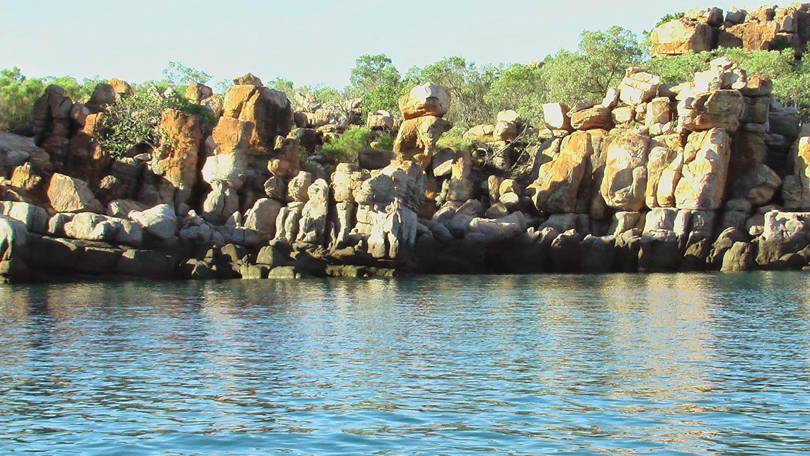
The narrow passage between Gray and Glauert Island.


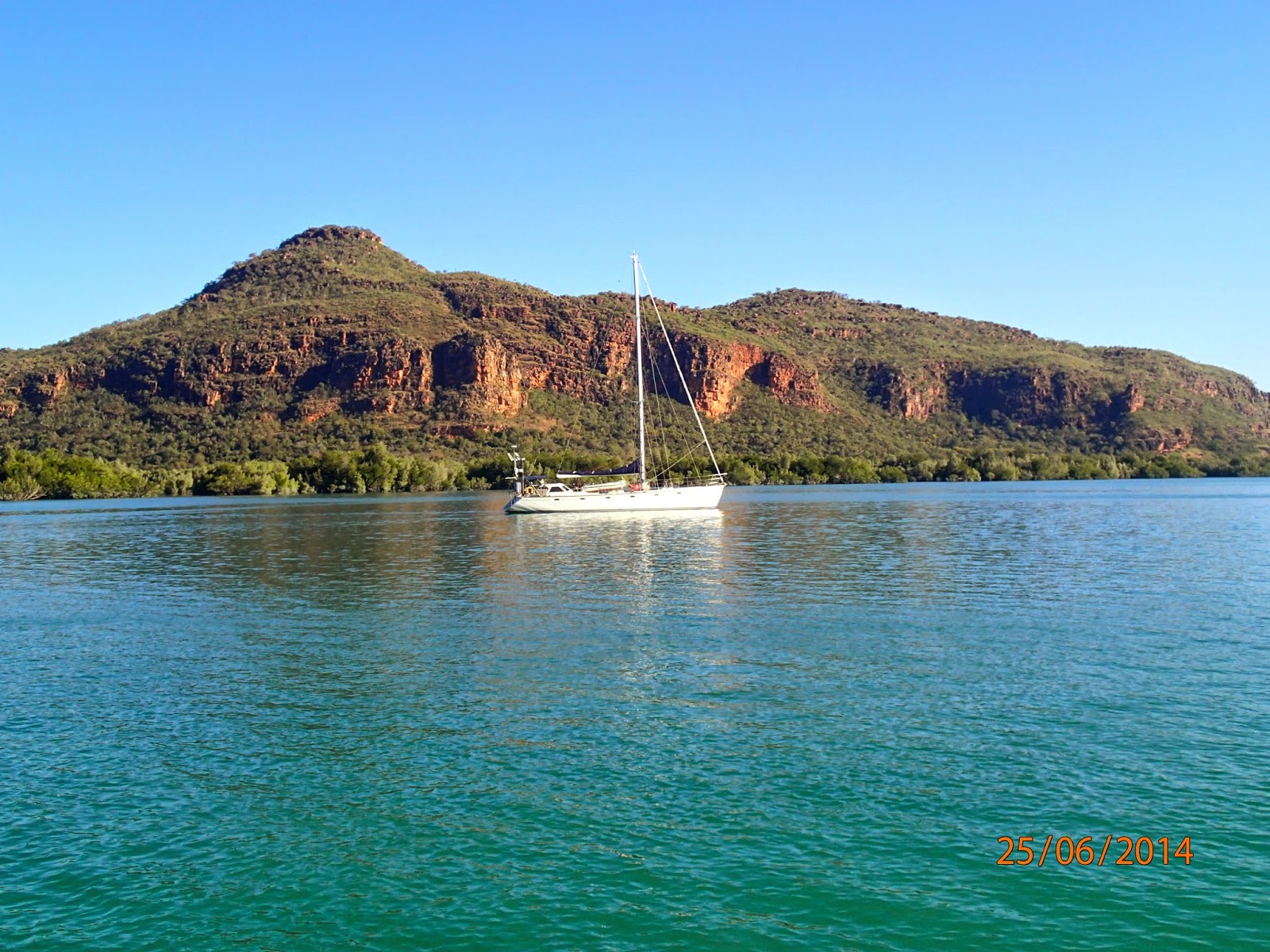
The following morning we set off just before slack tide for the short ride across Port Nelson to our next anchorage, Ivy Cove. This well protected anchorage is inside the narrow and fast flowing passage that separates Glauert and Gray Islands, of the Coronation Island group. 


The "Ivy" tree.


This passage is best negotiated in slack water at the end of low tide and entering mid channel to avoid the hazards at either end of the northern or southern entrances. Once inside the passage you can anchor in the little cove on the west side of Glauert Island, just out of the tidal stream and wind from every direction. 


"Ivy - 19/10/1891".

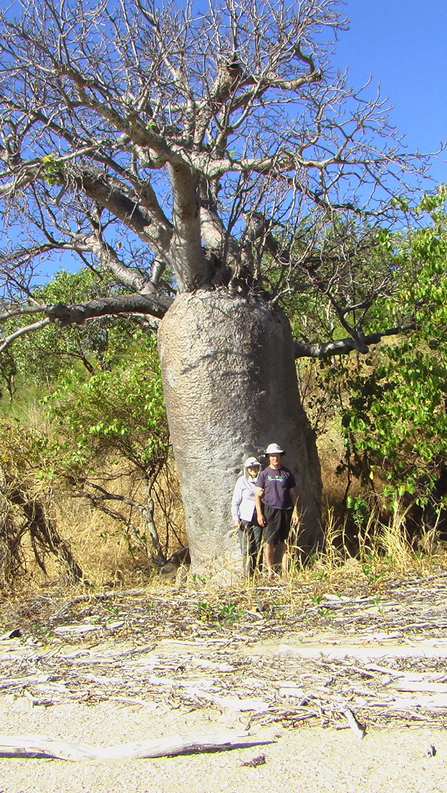
There is a large boab tree sitting in the centre of the beach just on the tree line, and it is well worth exploring. The engraved boab tree features the date 19/10/1891 and was carved by the crew of the "Ivy", a local pearling schooner that operated in these waters at that time. 


A recommended great spot, Careening Bay, was just south of the Coronation Islands and definitely a place we wanted to see, but we decided that we would see it on our way back. It was already July and we had a few issues playing on our mind. Firstly, we still had a long journey in front of us to get to Derby and then back to Darwin. Secondly, and probably more importantly was the fact that the dry season was in full swing and the waterfalls that we were still to see, were drying up fast.


Bat Island Beach.


So over the next few days we quickly ticked off Bat Island Bay, in the lee of Cape Brewster, and then rounded Red Bluff and sailed into Port George IV. 


Port George IV is really a large bay that is well protected by Augustus Island, and hence has some very well protected anchorages. One of the best being Tenggara Bay. This bay can seem difficult to navigate at first as the entrance is almost completely fenced off with buoys, to alert the presence of pearl farms, but if you follow the buoys south and then turn into the bay just near the southern beach, the access is relatively easy. The southern beach offers good protection from the trade winds and is great place to explore four beaches in the vicinity.

The only problem with Port George IV is transiting the notorious Rogers Strait in the south that separates Augustus Island from the mainland. This area is unchartered and there are only stories and 'mud maps' to help you navigate the strait. If you can obtain some co-ordinates from someone who has recently made the crossing then this is a distinct advantage. To add to the complexity there are many reefs, mud banks and some pearl farming activities are still in operation within the area, that make the safe channel through the strait a very narrow one.

The timing of your transit through the strait is probably the most crucial issue. Firstly, it is best to negotiate the passage (from both the north and the south) on a calm day, at slack water and a neap tide where the flow within the passage is at its weakest. Anchor at Kuri Bay or the neighbouring bay to await timing if heading north, or await in Tenggara Bay if proceeding south. Secondly, to allow passage south from Tenggara Bay you need the incoming (flood) tide. We waited in Tenggara Bay and left halfway through the tidal cycle (heading towards high tide) and arrived at the entrance to the strait at 1.30 pm, an hour later. We then motored through the strait just before high tide (2.40 pm), and had anchored by 3.30 pm. This was a great run - assistance of the flood tide down, gentle flow and deep water through the passage, and anchored before the outgoing (ebb) tide really got started. 


Needle Rock.


Anchoring for the night in the un-named bay next to Kuri Bay, as we realised that the last obstacle “The Needle” needed a reasonably high tide and either a flood tide or slack water, anything really, other than the ebb tide that was now pushing against us.


Once past this obstacle the next morning we sailed south to Sampson's Inlet. Billed as the cyclone anchorage for the Kimberley we knew it would be good. After anchoring we spent the afternoon checking out the inlet. There were two waterfalls to check out plus three barges.


Accommodation and Gym.


On investigation the barges (one complete with gym equipment) obviously part of a pearl lease, were all abandoned and the waterfalls were well on their way to a trickle, but they were still beautiful.


After two lovely days in Sampson's Inlet, you guessed it, time to move on. We had a good sailing day so we made the short hop south to Deception Bay in good time. Deception Bay provides many good anchorages for winds from all aspects, except probably a westerly. It is also a playground for whales and we saw many inside the bay and outside in the larger Collier Bay. It appears they are also pretty used to many sailboats and cruise boats getting close and then hanging around to check them out, which is what we did while they flipped and flopped. We decided to stay two days in Deception Bay as it was pretty and comfortable. 

Since David and Lyndell had left us we had not seen another boat at all. Finally, we did see signs of life when a few of the larger cruise boats that operate out of Broome and see all the sights as far north as Collier Bay, made it to Deception Bay. Though they were way too busy getting through their hectic schedule to contact us by radio. However, we did manage a visit from a Western Australian Fisheries patrol boat. This indeed was a highlight for us as we got to have our first conversation with another human being, in weeks. Plus we didn't have any fish on board except some frozen smoked salmon, so we didn't have to worry about the possibility of a fine either.  


Langgi stone figures.


The following morning we headed south to Langgi to see the stone sculptures, at the beginning of the flood tide. One thing you have to contend with when you come to the western Kimberley is the huge tides, some of the biggest in the world, and none more so than in Collier Bay and King Sound. 


You have to be mindful that when you are travelling in these two large bays that you have to go south on a flood tide (incoming) and hopefully complete that journey, reaching your destination within six hours. Otherwise the tide will turn and you cannot push against it unless you have a big boat with a very strong motor and using heaps of fuel. If you do not reach your destination in the allocated timeframe then you have to anchor to await the next flood tide. This sounds simple but in reality it can be difficult in Collier Bay as there are not that many anchorages to be found. The area is inadequately charted and parts are uncharted, there are reefs along the coast, and there are no bays/headlands for protection. So if you do not make it to Raft Point it is a matter of finding shallow water, a shoal patch, and anchoring there. Hoping the anchor will hold when the tide turns and the weather is kind.


The small opening from Collier Bay into Langgi.

The trip to Langgi was quick and we anchored outside the small opening in 20m of water, on a shoal patch. We then headed inside the small passage in the dinghy. We got there four hours before high tide and were able to see most of the stone sculptures before they were covered by the incoming tide.


Langgi feeder creek.


We also timed it to see the small feeder creek which you cannot access at low tide. So the timing was perfect really. The stone has been eroded by water and wind over millennia and they are a photographers' dream.


On return to the boat we were greeted by some whales that came close to the boat. Maybe to check us out. We watched for a little while but we really had to go as we only had three hours of the flood tide to make it to Raft Point. We knew we were not going to make it. So we kept going until the tide went slack and put the anchor down on a shoal patch. When the tide turned we just waited to see if it was going to hold - it did. As the tide really got going it was scary as it was rushing past us and thankfully the weather was benign. As the sun dropped down we saw a pod of whales surface silently right beside the boat. It was unreal looking into the eye of a large humpback that was checking us out.

As soon as the tide turned at 5am the next morning we pulled up the pick and let the current take us south. We managed 5 knots with the motor just idling allowing us to steer the boat properly. When the wind showed up we popped up the jib and managed 9 knots. This got us to Raft Point very quickly and we had anchored in the lee of the headland by 9am.


Raft Point.


Tuesday, 24 June 2014

17) Western Australia: Prince Fredrick Harbour to Port Nelson. 24 June to 3 July, 2014.


Heading south in Prince Fredrick Sound.


Again the weather forecast was predicting a few windy days of 25 to 30 knots of trade winds so we all decided that the Hunter River would be the place to hole up while the wind blew. 


Escarpment of Lower Prince Fredrick Harbour.
The Hunter River is a large river system located at the bottom of Prince Fredrick Harbour and only a day sail away. Decision made, David and Lyndell left at first light and way before us, as they wanted to motor quickly down the Sound and get down into the river before the winds got too pronounced. We on the other hand needed the winds so we took our time getting going this morning. 


Waiting for the winds to arrive every morning was our usual pattern, when we were on the move. Generally in the Kimberley, the winds would start anytime between about 6 and 10 am, but mostly by 7 or 9 am every morning. They would also predictably be from the South to East quadrant, at this time of year and would be the strongest in the morning decreasing through the day. They would then often die down in the evening and almost peter out to nothing overnight. So it was a real diurnal pattern and one we really liked. It allowed a good night's sleep and if the winds started before our usual rising time then the wind generators would kick in and wake us up, so we could get going for the day. Having said that sometimes the weather would change unpredictably and upset the apple cart, but on the whole we couldn't complain.

We set out at 7am and had a good sail down Prince Fredrick Harbour towards the mouth of the Hunter River. About 4pm the winds decreased so we motored the last hour or so. We knew we would not be able to enter the unchartered Hunter River in the dark. The rule of thumb in the Kimberley is that you make passage through the day and be anchored by the time the sun goes down. The Kimberley is extremely dangerous because of tides up to 12m, strong currents in the Sounds or through narrow passages and unknown hazards under the waterline. In addition a lot of the Kimberley coast is unchartered or at best inadequately surveyed, so having daylight is often preferred by most sailors, unless of course you are off-shore and in deep water. 

Naturalist Island at dusk.


So we anchored on the north-west side of Naturalists Island just as the sun was setting. This is a very pretty spot and was named because of a team of naturalists, that had previously visited the island. Though we were only stopping for the night and would check out the island on our return.


Twin peaks.

The next morning we motored the last hour down to the bottom of Prince Fredrick Harbour, York Sound and into the mouth of the Hunter River. The river itself is very large and wide and is conspicuous given the landscape changes from undulating lands to an escarpment. At the mouth there is a tall twin rock formation that is truly stunning. You need to enter Porosus Creek mid channel and do not cut either corner as the water shallows significantly due to sand bars.


Reverie at anchor, Porosus Creek.

The Hunter River has to be one of the scariest places we visited in the Kimberley. While it is a pretty, sheltered anchorage and well recommended, the disconcerting thing is that you are constantly surrounded by crocodiles. You may say so what there are crocodiles everywhere in the Kimberley and that is true. You do see them occasionally lazing on beaches and even when you don’t see them you still know they are there. 


Our afternoon stalker.

However, in the Hunter and its tributary, Porosus Creek (Crocodylus porosus, common name Australian Saltwater Crococdile) the population of crocodiles is huge. They all lie along the drying banks, catching and eating food or sun baking, at low tide. Then in the afternoon they sit around the back of your boat watching you. They take turns patrolling around the boat and then at night you hear them as they fight for the right to stake out your boat. 


Porosus Creek, evening visitor.


Yes, the river is saturated with them and they are stalking you, waiting for that opportunity when you make a mistake or get too close. It is really unnerving as it is a rare situation when humans feel and know they are on the menu. David and Lyndell counted thirteen crocodiles one evening around their boat. Admittedly they were catching and cleaning fish on previous days, but still that is a huge concentration. 


Port Nelson mainland, old Lava field.


After five days it was a relief to finally leave the Hunter River and return to pretty Naturalists Island. We all spent a lovely day checking out the north-west beach, fossicking for shells and generally lazing around. Apparently this beach is frequently used by charter boats to take passengers by helicopter to an isolated airstrip on the Mitchell Plateau.


The next day we left early and sailed all the way across York Sound, in a north-westerly direction. It was a long day and as the wind died we managed to motor around Hardy Point and into charted Port Nelson, before the last of the light faded. It is at this latitude where you start to encounter Whales. Southern Right and Humpback Whales migrate from Antarctica, across the Southern Ocean and up along both the Eastern and Western Australian coastlines to breed and give birth. On the west coast they spend 'the winter' (May to October) lolling around the tropical central and southern Kimberley coastline, up to 15 degrees south. Port Nelson is one of their favourite haunts.


Our first Boab.
It is also a point where you start to see a greater concentration of Boab trees dotted along the WA coast. The coastline is a stark contrast to the eastern Kimberley. 


'Dollar' shells.


Boab fruit.


Sadly Lyndell and David had come to the end of their time in the Kimberley and had to return to Darwin. They were going to spend a few days fishing around Coronation Island, then it would be off to the Maret and Prudhoe Island groups, for a few days before returning to Darwin. Back in Darwin they would take one week or so to reprovision the boat before slowly cruising the northern and eastern coast of the Northern Territory, and lastly crossing the Gulf of Carpentaria. They were hopeful of being able to put the boat into either the Port Douglas or Cairns Marina, for the upcoming 2014/2015 cyclone season. It was very sad to see them go, as we had become very close and we knew we would miss them.


Thursday, 19 June 2014

16) Western Australia: Prudhoe Island to Prince Fredrick Harbour. 19 - 24 June, 2014.

South Montague Sound.


It was sad leaving Montague Sound but we were not even half way through the Kimberley and had to make haste. We set out and sailed north to the Prudhoe Island group, while Melita went west.


David and Lyndell had been to Prudhoe and Bigge Islands in 2013, so they decided as it was a very calm day they would attempt to take the 'short cut' between the mainland and Bigge Island, rather than spend days going around it.  

The passage through Scotts's Strait is not to be taken lightly and it was the one we didn't want to do. The current is very fast so is best only negotiated at slack tide and in calm weather. It is also rock strewn mid channel so you can understand why we elected to go the long way around. David and Lyndell had been given guaranteed safe coordinates for the passage and thought since it was so calm they would give it a go. We just hoped we would see them in three day’s time at the planned rendezvous, Kartja Island. 


Northern beach, Quoy Island.


We managed to sail at least half way to the Prudhoe Island group, but then the wind died completely and we had to motor the rest of the way. Prudhoe and the other two small islands, Quoy and Gaimard, are very dry and stark.


At anchor in Shelter Bay, looking south.
However, this group does offer yachts the best offshore island anchorage on the coast. The anchorage is very well protected from winds and swell coming from the SW quadrant through N and back around to the SE quadrant. They don't call it Shelter Bay for nothing.


Turtle tracks up to the nest.


It also has some of the best beaches on which to roam, complete with turtle or crocodile tracks. Don't get these tracks wrong, an alternate pattern for crocodiles and a symmetrical one for turtles. Take your pick, but we knew which beach to land on.


The 'Council of Old Men'.

We had this paradise all to ourselves - wonderful, so we spent a few days traversing the beaches and checking out the three islands by dinghy. The rock formations were also very interesting, and I christened one group "the council of old men" as that is what they resembled, sitting there in two rows of five.


On our departure the winds were still minimal forcing us to motor the short distance north and then west around the top of Bigge Island, in the Bonaparte Archipelago. We then anchored in its most north-western bay, known as Wary Bay. It is not a very good anchorage as you have to anchor a fair distance offshore as the bay is filled with rocky outcrops due to its extensive fringing reef. No snorkelling or diving here though due to the large resident crocodile. The bay is also very exposed to the westerly wind and swell.


'White man' at Wary Bay.
But it does have one of the best art galleries in the Kimberley and is located right on the
beach. No walking for hours this time. The art depicted here is the well-known and photographed, Kaiara face and several images where the local indigenous people have recorded seeing European men. Unmistakable, sitting in their boats, with their large hats and their smoking pipes. 


Later in the day we sailed and anchored in a bay further south, known as Boomerang Bay. A better overnight anchorage but still wind and swell exposed. Luckily for us it was a nice calm night.


The next day the winds picked up and we caught the current down the west coast of Bigge Island and across the end of Scott's Strait and into York Sound. Twice during this journey we had to radically adjust our course to miss two uncharted rocky outcrops. The depth indicator suddenly alarmed and we dropped from 35m to 10m depth in a matter of minutes. Both times we just ignored the sails and did a complete 180 degree turn under power to avoid hitting what we thought would be submerged rocky outcrops. Thank goodness we had set the alarms and managed to get around safely by the time the depth indicator registered 5m. We then sailed further west away from Bigge Island, before adjusting our course south again. Crisis averted. Just remember if you are sailing south down Bigge Island, keep the small group of rocks off the island to your port (left) and Tooth Rocks to starboard (right).


Other than the above hair raising minutes it was a pleasant and very quick sail south to Kartja Island. It wasn't until we rounded the bottom of the Island that we saw Melita safely anchored just off the beach, as the anchorage is in the south east corner of the island. We pulled down our sails and started the motor just as David in his tinnie pulled alongside. David had been out fishing most of the afternoon on the reef that lies just off the beach and had bagged a few for dinner. He showed us a deep hole away from the reef and we dropped anchor.

During sundowners we all hatched a plan to take Melita into the large unnamed eastern bay the following day to check out some caves and if the tides were right maybe check out Rainforest Ravine. This large eastern bay in York Sound has not been surveyed at all but again luckily for us David and Lyndell had the coordinates from 2013. 


Each cave with headland and beach.
We took Melita across the bay and once past the small Anderdon group of islands we anchored in a little bay just to the east. This bay can be affected easily by the westerly wind and waves but it is okay for a day anchorage while you explore the caves. We then took the tinnie over to the shore just before low tide.


Entrance to cave No.1.

There are four caves, each with a beach in front and a little headland separating them. You can walk around to each beach only at low tide and each cave is dry and accessible, but by half tide the caves are inundated. The northern cave is the best as it is quite extensive and has a resident bat population.


We knew if we were going to visit Rainforest Ravine we would need several hours. Firstly, you need a rising tide to get up as far as possible by tinnie. Then it is also best to go 1 - 2 hours before high tide so you can return 1 to 2 hours after high tide, to safely access your tinnie. This way you have several hours to walk from the lower ravine to the upper ravine. Having to wait until lunchtime for low tide to see the cave system we knew it would be too late to see the Rainforest Ravine. At 6 pm it would be high tide and that meant walking back over boulders and submerged mudflat in the pitch dark. Even doing this without the threat of the large resident crocodile was too much. So we decided to abandon the plan.

Some exercise. Prince Fredrick Harbour.


Instead an afternoon stroll around the beaches and rock formations of stunning Prince Fredrick Harbour did the trick. 


Looking south. Prince Fredrick Harbour.